
Topic
About Trails in the Mat-Su Borough
Trail Maps
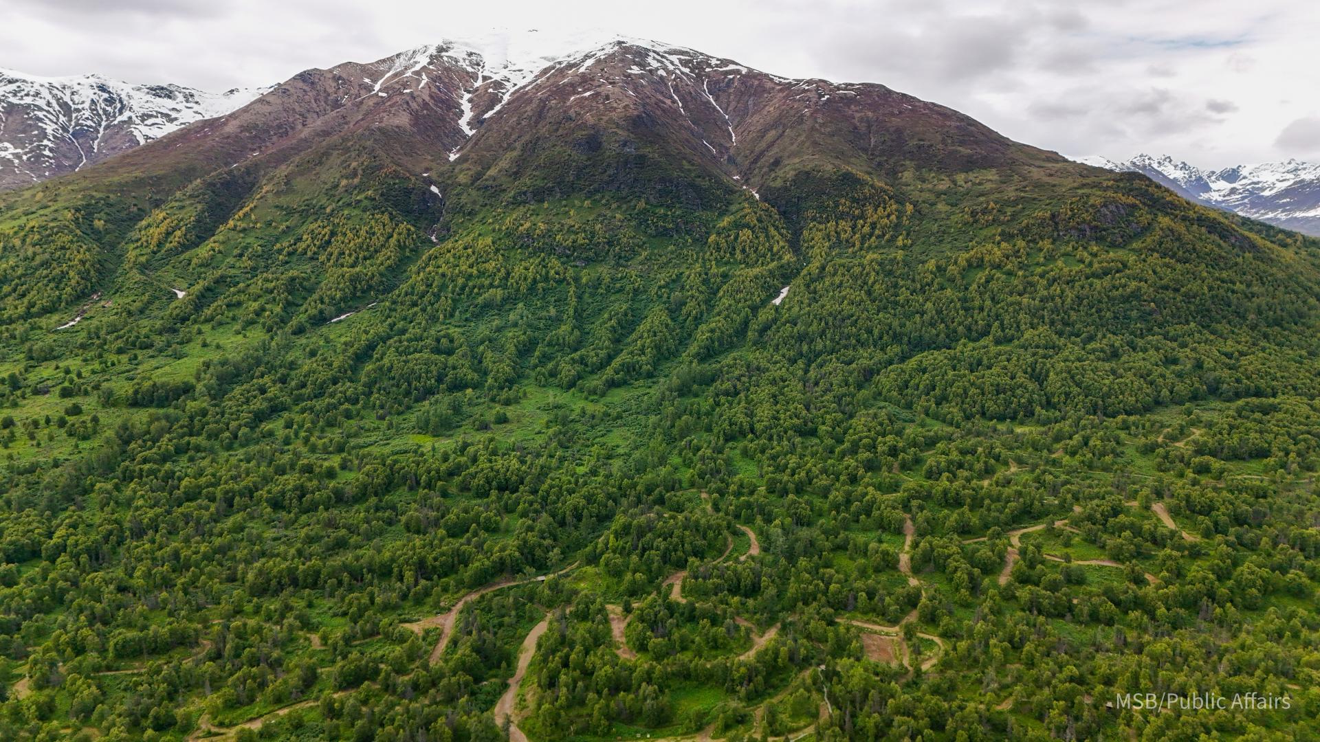
The Mat-Su Borough is home to over 1,200 trails totaling almost 3,200 miles. The Borough released an interactive map in 2025 for residents and visitors to explore and enjoy all the incredible recreational opportunities the area has to offer. Click the blue button titled 'Interactive Trail Maps' to access.
Keep in mind: Some of the trails are on Borough lands and under Borough management authority, however many of the trails are outside the Borough's jurisdiction; this availability of data is not an assertion by the Borough of the trail’s management responsibility or legal status.
Be advised: Some trails may encroach on private property. Although they may have been in use for many years, trail access may be restricted at any time. It is the user’s responsibility to respect property owner’s rights and stay out of posted areas.
Continued improvement to the data will be ongoing. If you have additional information about a trail that you would like to share to further refine the accuracy, please get in touch with the Land & Resource Management Department.
Winter Trail Grooming
The Borough operates an interactive Winter Trail Grooming Map. Check your favorite trails to see if they have been groomed for winter fun. Reference trail colors on the map to see how recently they’ve been maintained, and click on a trail to get detailed use information. Please be aware of the expected uses of a trail before you recreate.
Winter trails throughout the Mat-Su are maintained in large part by volunteers – we appreciate their hard work and the fact that we can now highlight the efforts of these partner organizations on the map.
Grooming data is updated in near real time - please respect the operators’ efforts and wait several hours after grooming occurs to allow trails to set.
Services
Trails
Aurora Dog Mushers Trail System
Trail system maintained for dog mushing in the Big Lake/Knik area.
Big Lake Area Snowmachine Trails
Trail system maintained by volunteers for primarily motorized use in the Big Lake/Knik area.
Nancy Lake State Recreation Area
Nancy Lakes State Recreation Area features a lake system ringed with unspoiled forests, ideal for canoeing, fishing, hiking and camping. In winter, the rolling topography is ideal for cross-country skiing, dog mushing and snowmachining.
Haessler–Norris Trail System
Trail system maintained by volunteers for primarily motorized use in the Big Lake/Knik area.
Lake Louise Snowmachine Trails
The Lake Louise Snowmachine Club supports and maintains trails in the Lake Louise and Copper Basin area, specifically Crosswind, Tolsona, Eureka Moore Lake, and other side and transportation trails.
Skeetawk Hatcher Pass
Skeetawk is a community driven alpine ski area directed by a volunteer board of directors and managed by professional recreation and ski industry leaders.
Sheep Mountain Trail System
Trail system maintained by volunteers for primarily motorized use in the Sheep Mountain area.
Talkeetna Lakes Trails
Summer and winter recreation opportunities in Talkeetna Lakes Park include skate and classic skiing, hiking, biking, jogging, and fishing access.
Government Peak Rec Area
The Government Peak Recreation Area (GPRA) offers summer and winter recreation for skiiers, hikers, bikers, and more.
Matanuska River Park Trails
Matanuska River Park has approximately 1.6 miles of trails, which form a loop from the parking areas to the river. The trails connect the campground, day use area, and athletic fields to the riverside.
Plumley-Maud Multi-Use Trail
This multi-use trail is open year round and travels through wooded stands of birch, spruce, and cottonwood.
Denali State Park
Denali State Park is an integral part of one of North America's most spectacularly beautiful regions. The park's 325,240 acres provide the visitor with a great variety of recreational opportunities, ranging from roadside camping to wilderness exploration.
Willow Area Trails
Ayrshire Road Winter Trails
Trails winds through remote terrain near Susitna Station, offering multi-use access while emphasizing respect for private property and safe sharing between snowmachines and dog teams.
Fish Lake Trails
Fish Lake Winter Trails are maintained by volunteer partner Denali Nordic Ski Club. Follow their Facebook page for trail updates. Also see their website: www.denalinordicskiclub.org
Hatcher Pass State Recreation Area
The Hatcher Pass area provides access to a fantastic summer playground and a true winter wonderland.
Eureka Area Trails
The Eureka Trail System offers a network of winter trails ideal for snowmachining, skiing, and remote exploration.
Palmer-Moose Creek Trail
The Palmer-Moose Creek Railroad Trail is a year round, non-motorized trail following an old railroad bed along the Matanuska River.
Kroto Creek Winter Trailhead
Pioneer Ridge Austin Helmers Trail
This trail travels from a forested area to above tree-line where it traverses the northeast slope of Pioneer Peak.
Morgan Horse Trail
The Morgan Horse Trail is an all-season trail running between the Lazy Mountain Recreation Area and Maud Road.
Crevasse Moraine Trail System
Crevasse-Moraine’s approximately 6.7 miles of trails wind through glacial ridges and depressions, offering year-round recreation across forested loops, open terrain, and snowy slopes.
Eska Creek Falls
At elevation 1,800 feet, the Eska Falls trail opens into the alpine, offering sweeping views of the Chugach Mountains. In fall, groundcover and foliage carpet the slopes in burnt orange and red leading up to the golden-gray rocks of Eska Peak.
Alcantra Trail System
Joggers, walkers, bikers, and disc golf players are traveling this 1.6 mile paved path. It forms two loops. One circles the baseball field. The larger one runs parallel to Serendipity Loop.
Butte Trail
The Butte is the most popular hiking trail in the Mat-Su Borough. The first mile is a gravel trail that winds through thick forest. Stairs take you nearly above treeline via switchbacks. A silty path and more stairs lead you to the igneous rock summit.
Matanuska Greenbelt
The Greenbelt are loops of trails between the Palmer-Wasilla Hwy, the Glenn Hwy, Parks Hwy, and Trunk Rd. Trails traverse 4 collaborating land owners: the Mat-Su Borough, the Mat-Su College, UAF Experiment Farm, and the Matanuska Lakes State Rec Area.
Lazy Mountain Recreation Area
Two trail options: the Lazy Mountain Trail is 3,000 feet in less than two miles. The longer, less steep, Lazy Moose Trail, zigzags up the hill for three miles. Lazy Moose reconnects with Lazy Mountain Trail above the first picnic table.
Matanuska Peak Trail
The trail passes through forest to alpine to talus field to pinnacle. The view from Matanuska Peak is spectacular!
Settlers Bay Coastal Trails
Trails at Settlers Bay Coastal Park are a part of 295 acres of land that were donated to the Mat-Su Borough by the Greatland Trust.
Departments & Divisions
Communities
Big Lake
Big Lake, Alaska, is a scenic community 13 miles from Wasilla. It offers year-round outdoor activities like boating, fishing, skiing, and mushing. Three state parks and stunning natural beauty make it a haven for recreation lovers.
Buffalo Mine/Soapstone
Buffalo Soapstone, Alaska, is a serene community with 1,021 residents as of 2020. Covering 22.6 square miles, it offers stunning landscapes, a family-friendly vibe, and activities like hiking and wildlife observation
Butte
Butte, Alaska, with 3,589 residents as of 2020, is nestled between the Matanuska and Knik Rivers. It offers outdoor activities like hiking Bodenburg Butte and recreation in the Knik River area. Its scenic beauty and amenities make it a vibrant community.
Chase
Chase, Alaska, is a remote community with 19 residents as of 2020. Spanning 169 square miles, it offers tranquil wilderness, vast landscapes, and Alaska Railroad access, ideal for outdoor enthusiasts seeking seclusion.
Chickaloon
Chickaloon, Alaska, is a community with 254 residents as of 2020. Rooted in Athabascan heritage, it offers cultural experiences and natural beauty, including the Ya Ne Dah Ah School, which preserves the Ahtna Athabaskan language.
Farm Loop
Farm Loop, Alaska has 2,747 residents as of 2020. Spanning 9.2 square miles, it offers rural charm near Palmer. Growing since 2010, it appeals to those seeking natural beauty, tranquility, and access to nearby amenities.
Fishhook
Fishhook, Alaska has 5,048 residents as of 2020. Covering 65 square miles, it features lakes and the Little Susitna River. Offering scenic beauty, outdoor activities, and rural charm, it provides access via Wasilla-Fishhook Road.
Gateway
Gateway, Alaska has 5,748 residents as of 2020. Spanning 16.8 square miles, it blends suburban and rural living. Near George Parks Highway, it offers scenic beauty and urban access, making it a convenient, appealing community.
Glacier View
Glacier View, Alaska has 375 residents as of 2020. Covering 234 square miles, it offers stunning Matanuska Glacier views. With skiing, hiking, and Glenn Highway access, it provides a peaceful lifestyle amid Alaska’s natural beauty.
Houston
Houston, Alaska, is the home of the fireworks! With a population of 1,975 in 2020, this small city offers fishing, hiking, and more for you and your family.
Knik-Fairview
Knik-Fairview, Alaska has 19,297 residents as of 2020, making it Alaska’s largest CDP. Spanning 74.55 square miles, it blends suburban and rural living. Near Anchorage and Wasilla, it offers scenic beauty and a thriving community.
Knik River
Knik River, Alaska has 792 residents as of 2020. Spanning 91.68 square miles, it offers a tranquil lifestyle. Located southeast of Palmer, it’s known for fishing, hiking, and wildlife viewing near the scenic Knik Glacier.
Lazy Mountain
Lazy Mountain, Alaska has 1,506 residents as of 2020. Covering 58.8 square miles, it offers a serene lifestyle. With hiking trails, scenic views, and proximity to Palmer, it blends rural charm and natural beauty.
Louise, Susitna, & Tyone Lakes
Meadow Lakes
Meadow Lakes, Alaska has 9,197 residents as of the 2020 census. Covering 78.64 square miles, it blends suburban and rural living. West of Wasilla, it offers urban access and peaceful surroundings, perfect for enjoying Alaska’s natural beauty.
North Lakes
North Lakes, Alaska has 9,450 residents as of 2020. Spanning 17.23 square miles, it blends suburban and rural living. Scenic lakes near Wasilla and Palmer offer recreation and urban access, creating a balanced Alaskan lifestyle.
Palmer
Petersville
Petersville, Alaska has 27 residents as of 2020. Covering 462.5 square miles, it offers a remote lifestyle. Near Denali National Park, it’s known for outdoor recreation and the historic Forks Roadhouse, a symbol of its rich history.
Point Mackenzie
Point MacKenzie, Alaska has 1,852 residents as of 2020. Covering 164.79 square miles, it offers rural living. Across Knik Arm from Anchorage, it’s known for the proposed Knik Arm Bridge and for the port bearing the same name.
Skwentna
Skwentna, Alaska has 62 residents as of 2020. Spanning 445.86 square miles, it offers a remote lifestyle. Located 61 miles northwest of Wasilla, it’s a checkpoint on the Iditarod Trail and is accessible via the Skwentna Airport.
South Lakes
South Lakes, Alaska has 5,229 residents as of 2020. Covering 8.28 square miles, it blends suburban and rural living. Between Wasilla and Palmer, it’s named for a chain of lakes offering scenic beauty and recreational opportunities.
Susitna
Susitna, Alaska has 11 residents as of 2020. Spanning 218.8 square miles, it offers a secluded lifestyle. Located near Cook Inlet, it’s rich in Athabaskan heritage and was home to Shem Pete, a famed historian and cultural figure.
Sutton
Sutton, or Sutton-Alpine, Alaska has 1,038 residents as of 2020. Covering 58.1 square miles, it offers rural and suburban living. Near the Matanuska River on the Glenn Highway, it’s rich in coal mining history tied to Eska and Jonesville.
Talkeetna
Talkeetna, Alaska has 1,055 residents as of 2020. At the confluence of three rivers, it’s a gateway to Denali National Park. Known for its arts scene and outdoor activities, Talkeetna offers an authentic Alaskan experience.
Tanaina
Tanaina, Alaska has 8,817 residents as of 2020. Spanning 30.83 square miles, it blends suburban and rural living. Located 4 miles north of Wasilla, it offers urban access, scenic beauty, and proximity to Alaska’s natural wonders.
Trapper Creek
Trapper Creek, Alaska has 499 residents as of 2020. At mile 114.5 on the Parks Highway, it’s the southern gateway to Denali State Park. It offers rural living and access to activities like hiking, fishing, and wildlife viewing.
Wasilla
Willow
Willow, Alaska has 2,196 residents as of 2020. Located 26 miles northwest of Wasilla, it offers outdoor recreation like fishing, hiking, and access to Denali State Park, making it ideal for nature enthusiasts.